I did a quick WOD today just to get in some exercise, which I followed with a 25 minute stretchy yoga class. I also walked a mile, so that counts as exercise as well. When you combine it, it's real.
The WOD for two days ago was:
Truly the Best Anagram of a Name Ever!
A Blog Dedicated to getting off the couch
I did a quick WOD today just to get in some exercise, which I followed with a 25 minute stretchy yoga class. I also walked a mile, so that counts as exercise as well. When you combine it, it's real.
The WOD for two days ago was:
I signed up for parkour too late this week, and my regular class was full so I had to do the geriatric one earlier in the day. I really like the seniors ( :) ) in the class, but it's earlier in the day, a half hour shorter, and it doesn't push me as much. Going to the class I was able to see that the other class (where I am consistency one of the slower, less balanced and less sure of myself people) has really helped me to improve a lot. Yay! After class I decided that I should get in some more exercise, and since I was already warmed up, I could just WOD.
I looked at my old gym, and their WOD from yesterday was:
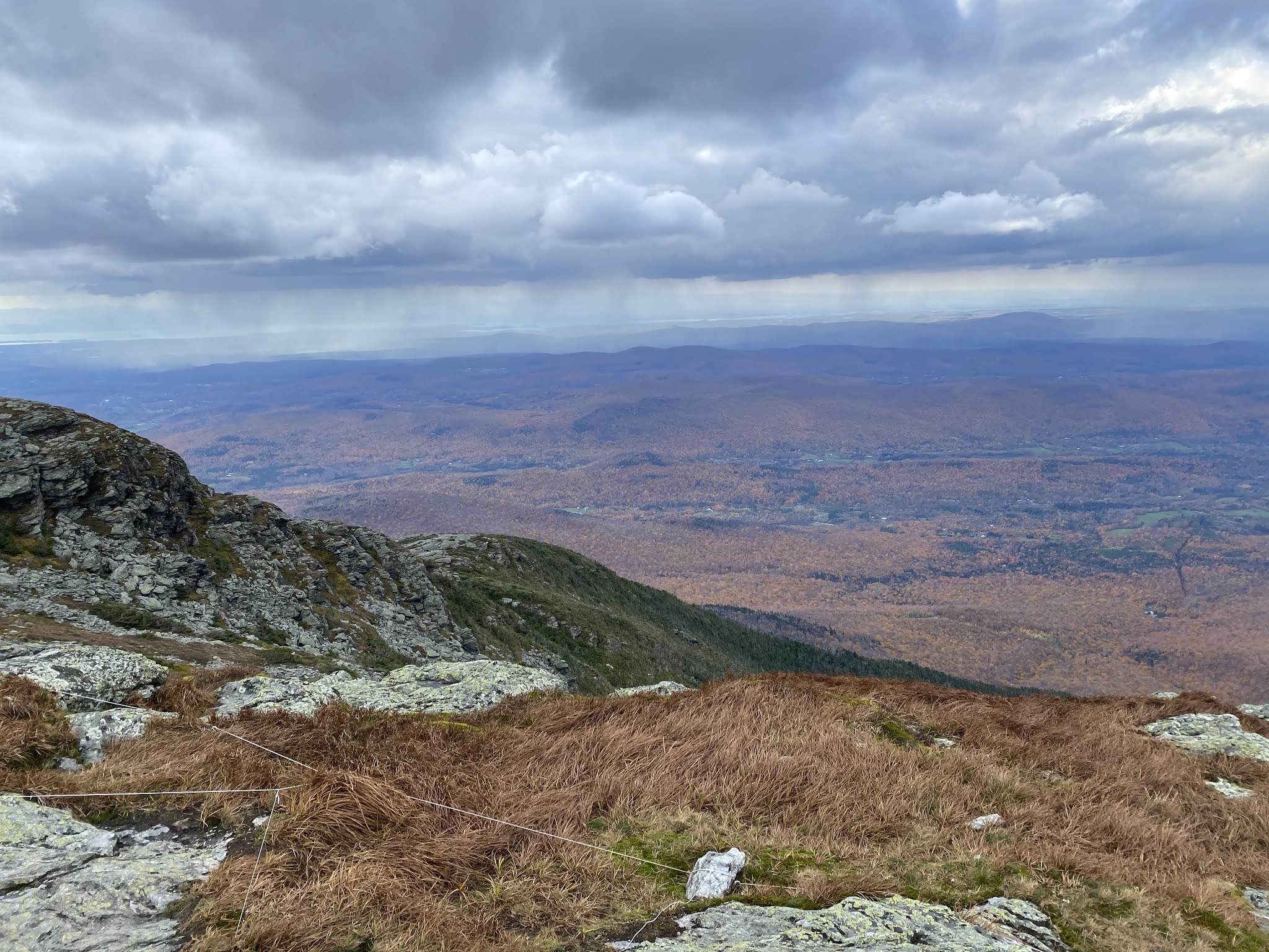
Mt. Mansfield is definitely one of my favorite 4000 footers that I've done, 2 thumbs up, definitely recommend. As I drove to it, I wasn't completely sure. It rained all day the day before I hiked it, and the clouds were still clearing, the mountain looked beautiful, Vermont-like, but also a little intimidating. Don't let it scare you, it was a good one!
I decided to do a loop hike - I got up and got there with plenty of time. So, I went up Halfway House trail, across the ridgeline on the Long Trail and then down the Sunset Ridge Trail. I was thinking about doing it the other way, but the Sunset Ridge is supposed to be the easiest way up (and therefore down) and Halfway House is steeper, and I was so glad I did Halfway House first. It was steep in a few places, with a slippery ladder, some rocky climbs, and a lot of switchbacking. I really liked the trail going up - it was full of little mossy glens and quiet spots where a moose or bear could (but at the moment happily wasn't) hang out. The trail was a little technical, a little challenging but not too difficult, and just really fun. When I got to the top where it intersected with the Long Trail I felt accomplished, and ate a cheese sandwich, some dried mango slices, and a banana. And then I got to walk about a mile of alpine ridgeline, which I just love so much! It was beautiful and the rocks were so interesting - they looked very scraped up by glaciers.
The view from the top was really pretty with Lake Champlain, the Adirondacks, and the fall foliage. It was really windy also, and I was pretty hungry, so I sat to eat some more cheese sandwich and some nuts and enjoy the view in the other direction of VT and into NH.
Looking at the storm, it seemed fast moving and thin, like it would pass over and move on. There was this one couple that was so close to the summit and they were like "is it exposed up there?" Sorry folks, yes, it is. And, here is what was coming towards us:My Monday hike was Camel's Hump which has a really cool name and is one of the five 4000 footers of Vermont. I had looked at several routes up the mountain, but by the time I woke up, packed everything, figured out directions and stopped for food, I knew it would be noon by the time I got to the mountain. The most direct route and easy route is Burrows trail which is 2.4 miles out and back, and I decided I better just do that since I didn't have a ton of time and was feeling a little nervous due to being in VT - like that's somehow different from NH? IDK, but still it was a good idea. It's getting dark earlier and earlier, and I didn't want to be out there after sunset.
I was a little nervous about the number of people, since it was a long weekend, but pulling into the parking lot it wasn't that bad, and on the mountain there were plenty of people, but not mobs. The hike was pretty much uphill from the start, right to the top where it was so windy that I took a few pictures of the view, and then descended to a lower elevation to get out of the wind, eat some cheese sandwiches and admire the view for real. It was pretty awesome to look from the top because I could see across Lake Champlain all the way to NY and the mountains in the Adirondacks! Definitely a different view than I'm used to, and the foliage was gorgeous - probably just a tiny bit passed peak but beautiful and so much color.
Before the trip I bought some new hiking shoes from REI, and some orthotics that have a special morton's extension that makes it so my big toes don't bend as much. They also have this bump in them that goes under the ball of my foot and is supposed to distribute the weight from the joint to the whole foot. I was a little nervous about the new set-up, but it was awesome! My feet were so much less sore on the hike, and at the top I thought about how much my toe didn't hurt.
The way down was kind of wet, and therefore slow going. In fact, some of my downhill splits are slower than the uphill ones - or about the same. I think mile 3 it was counting the time that I was wondering around up top, blowing around in the wind (it was so windy, a couple times I thought I would get blown over!) I was pretty happy with the hike - definitely a good day!
I realized that I haven't really done a 4000 footer this year, which is OK, because mountains don't always have to be 4000 footers, but the only one I was on was a bust. So, I wanted to at least get in one this year. I've been wanting to rehike Moosilauke because it was the first 4000 footer that I did solo, it's been several years, and I remember liking it. But, because of Covid the lodge that overlooks the mountain is closed, and so there's an extra walk to get in, so I couldn't decide if I wanted to do it. And then I decided, fuck it, I'm going. And, I'm glad I did! Even though I had to park 1.6 miles from the trailhead!
Once again I got a late start (around 7:30), but decided that was OK because it's not the longest hike. It's 3.7 miles each way, and even though it's one of the higher 4000 footers, it's not the most elevation gain. I think it starts pretty far up the mountain, and it's one that is uphill for most of the hike. In the end, I did 2913 feet of elevation gain and 10.42 miles in 7 hrs and 7 minutes, but only 6 hrs and 9 minutes of that was moving time.
It's a really nice hike, except near the top there are A LOT of stairs that are pretty exhausting, and since I didn't get started until around 11 ish, I was really hungry. Which you can see from my splits, that I slowed down (or, that I need to take it slower from the start.) Anyhow, on the way up, a lot of people passed me, but I was in a bit of a bubble on the way down, and almost no one did.
I wound up doing an out and back hike this time - I thought about the loop because I had liked it a lot the last time, but also the last time I was doing crossfit (and it better shape) and didn't have to hike an extra 3.2 miles, so I didn't. And, I really liked it this way too! The walk down was really nice, there were some steep spots where I had a hard time, but mostly stairs and rocks. My feet were really sore, and I was tired, but would definitely do again that way :)
At the top, it was a bit of a zoo, there were so many people up there. And, there were even people going up as I was heading back down. These two women asked me to take their picture, which I did, and then they offered to take one of me. I think it was a bit windy...I'm actually writing well after the fact, I forgot to blog about my Mt. Belknap hike, which I realized was a mistake, because it was an awesome hike, one that I would definitely do again. I went on Saturday of Labor Day weekend - I can't believe that Labor Day has passed - and it was a great improvement over Owl's Head! I was thinking about different routes for the hike, and thought about trying to park in the same little lot as last time, but it was so small, I figured it would be full. Looking at a map, I realized that Gunstock ski resort wasn't far away at all, and of course they would have a ton of parking, so I planned my hike around that. There were a million people and a bunch of tents when I got there. It could have been a ski sale - maybe should have checked it out, but I just got new skis last year, and I don't think I need cross country.
Anyhow, the plan was to do Belknap, which is the tallest mountain in the Belknaps, and then Gunstock. I had a cheese sandwich, pringles, and some nuts, and GPS with all trails. I did get a little carried away with my GPS, and went up this snowshoe trail, that I soon realized wasn't what I wanted to be on. Eventually I bushwacked to the actual trail. I managed to make a flat even walk in the woods into something difficult - good job me.
Some of the hike covered the same area as Klem and Mack, but then I turned off at a different trail to head up. I really liked the trail I took up, I took Birch to East Gilford which was the trail with a lot of elevation gain - E Gilford was not too steep, and was really slabby with opened sections and a few nice view points. I sat at one of the view spots and ate, and then went to the top and climbed the fire tower. While I was in the fire tower, these three guys came up, driving remote operated trucks. I was both impressed that their trucks made it all the way up, and annoyed at all the noise. Anyhow, I then took Blue trail to saddle to the top of Gunstock, where I sat at the top of the ski resort and finished my food.